The Sahara Desert, one of the driest places on Earth, used to have a huge river system coursing through it, a team of researchers from France and Mauritania reported in an article published in Nature Communications.
A satellite that can look below the Saharan sands detected an ancient riverbed – 320 miles long – in an area of northwest Africa where very little vegetation grows naturally today.
The ancient river, if it existed today, would be the eleventh largest in the world, regarding how much water it carried.
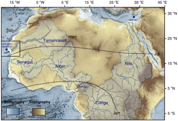 Map of the principal rivers of the Mediterranean, West African Tropical and Equatorial margins and related watersheds. The current active Nile, Senegal, Niger, Sanaga and Congo rivers watershed are drawn in light blue. The outlines and the main course of the Tamanrasett paleowatershed are drawn in blue and grey, respectively. (Image: Nature Communications)
USA Today quoted Peter deMenocal, from Columbia University’s Lamont-Doherty Earth Observatory, who described the river network as ‘monumental. Mr. deMenocal was not involved in the study.
Mr. deMenocal said:
“We have the smoking gun that this whole region – that today is without rainfall at any time during the year – supported a large, permanent system.”
The Sahara was once a lush, green land
Most of the Sahara Desert today, the world’s third largest desert after Antarctica and the Arctic, covering 9,400,000 square kilometers (3,600,000 square miles), is so hot and arid that virtually no plant life grows in it.
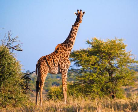
However, about 10,000 years ago, the area was full of animals roaming the region’s lush grasslands. According to human rock art, a wide range of fauna thrived in the region, including giraffes.
 The Sahara Desert was once a very different place.
Since the turn of the century, researchers have suspected that thousands of years ago a river spread across the Sahara Desert, along with giant lakes that supplied water to lush green grasslands and abundant fauna.
Vast river networks
Co-author, Charlotte Skonieczny of France’s University of Lille and IFRMER, and colleagues explained that the Sahara experienced a number of humid episodes during the late Quaternary (c. 12,000 years ago). During that period, there were vast river networks and enhanced freshwater delivery to the surrounding ocean margins.
Marine sediment records of Western Sahara suggest much of the material was carried there by flowing rivers. The researchers believe the West African margin of the Sahara had abundant river water.
In their quest for compelling evidence of a lost river, the scientists turned to radar images taken by a Japanese satellite. They used the Phased Array type L-band Synthetic Aperture Radar (PALSAR) – one of the Japanese Advanced Land Observing Satellite remote-sensing instruments.
The radar spotted traces of a large waterway that perfectly lines up with the seafloor canyon off the coast.
The river’s route also aligns with the path of the Tamanrasset, which stretched from modern Mauritania to Algeria.
Although the scientists are sure an ancient river existed in the Sahara, they cannot accurately date it. They suspect water was flowing along it from about 12,000 to 5,000 years ago.
The region used to be so fertile and green, that it is known as ‘The Green Sahara‘.
Citation: “African humid periods triggered the reactivation of a large river system in Western Sahara,” C. Skonieczny, P. Paillou, A. Bory, G. Bayon, L. Biscara, X. Crosta, F. Eynaud, B. Malaizé, M. Revel, N. Aleman, J. -P. Barusseau, R. Vernet, S. Lopez & F. Grousset. Nature Communications 6, Article number: 8751. November 10, 2015. DOI:10.1038/ncomms9751.
Video – The Sahara was once a jungle
This (unrelated to the study) Discovery video talks about what the Sahara Desert used to be like – a jungle.