There is an area in the US where the states of Utah, New Mexico, Colorado and Arizona meet, that has the highest concentrations of methane in the country. Hence it is called the Four Corners methane mystery. Nobody knows why methane levels are so high there.
Scientists from several institutions are currently in the Four Corners region of the US Southwest with an array of airborne and ground-based instruments, trying to uncover the reasons for this mysterious methane “hot spot” that was detected from space.
Christian Frankenberg, a scientist at NASA’s Jet Propulsion Laboratory (JPL), Pasadena, California, who is leading NASA’s part of the effort, said:
“With all the ground-based and airborne resources that the different groups are bringing to the region, we have the unique chance to unequivocally solve the Four Corners mystery.”
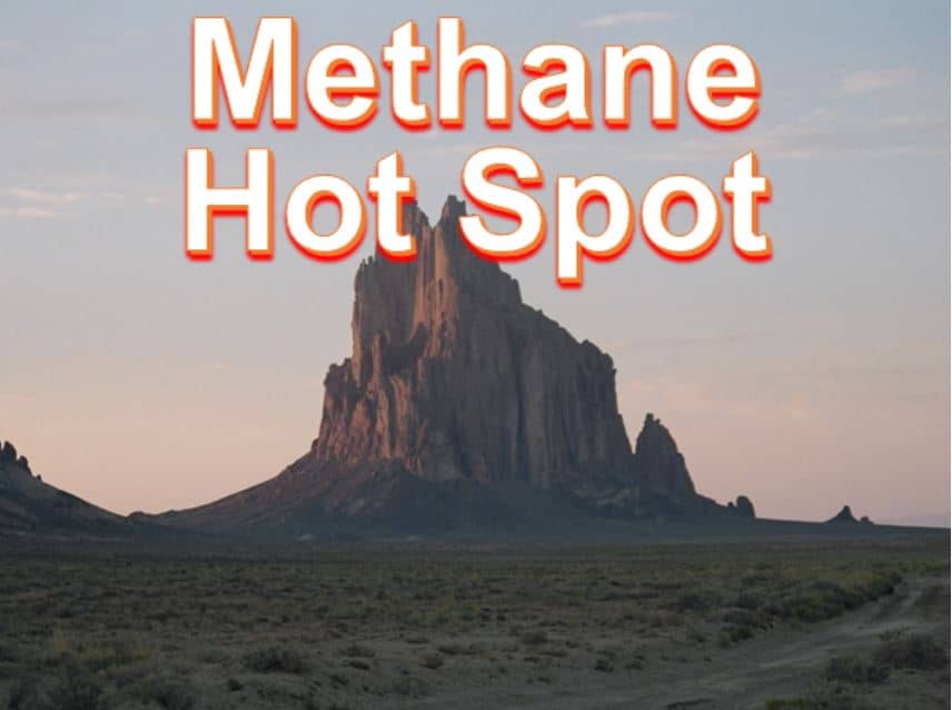
Shiprock, New Mexico, is in the Four Corners region where an atmospheric methane “hot spot” can be seen from space. (Image: NASA)
The project also has researchers from the University of Michigan, Ann Arbor; CIRES (the Cooperative Institute for Research in Environmental), Boulder, Colorado; and NOAA (National Oceanic and Atmospheric Administration).
Satellite instruments identified the hot spot
Last year, a group of scientists, including Frankenberg, reported that a small region around the Four Corners had the highest methane concentrations over background levels in the US.
A European Space Agency’s satellite with an instrument that measures greenhouse gases detected a persistent atmospheric ‘hot spot’ in the area from 2003 to 2009. The satellite detected much higher levels of methane than previous estimates.
The satellite observations did not have enough data to reveal where the methane in the Four Corners came from. Scientists believe likely culprits include venting from oil and gas activities, which are mainly coalbed methane exploration and extraction in this region, natural gas seeps, and active coal mines.
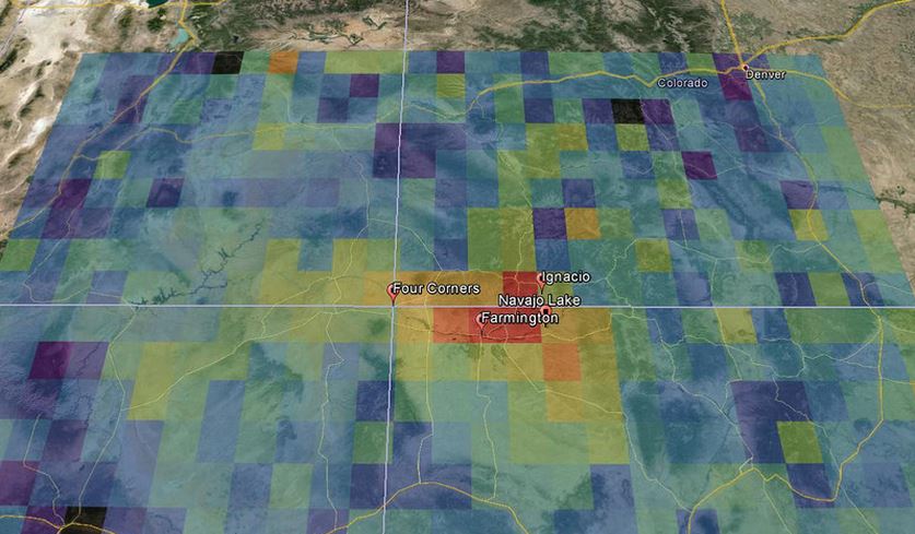
Hotspot of total column methane anomalies centered over the Four Corners region from 2003 to 2009, when a satellite-based methane-measuring instrument was operational. (Image: CIRES)
Scientists from NOAA, CIRES and Michigan University are conducting a field campaign called TOPDOWN (Twin Otter Projects Defining Oil Well and Natural gas emissions) 2015, bringing ground-based and airborne instruments to investigate potential sources of the methane hot spot.
The JPL researchers will join the project on April 17-24. The groups are coordinating their measurements, but each partner agency will deploy its own equipment.
The JPL team will fly two complementary remote sensing instruments on two Twin Otter research airplanes.
The AVIRISng (Next-Generation Airborne Visible/Infrared Imaging Spectrometer), which observes spectra of reflected sunlight, will fly at a higher altitude and will be used to plot methane locations at fine resolution over the entire region.
Using this data from airborne instruments and ground measurements from the other scientific teams, the HyTES (Hyperspectral Thermal Emission Spectrometer) will fly over where methane sources are believed to be, making additional, highly sensitive measurements of methane.
NASA wrote:
“Depending on its flight altitude, the NASA aircraft can image methane features with a spatial resolution better than three feet (one meter) square. In other words, it can create a mosaic showing how methane levels vary every few feet, enabling the identification of individual sources.”
The researchers hope that with their combined resources, they will be able to measure how high methane emissions in the region are, and where they are coming from.
CIRES scientist, Gabrielle Pétron, said:
“If we can verify the methane detected by the satellite and identify its sources, decision-makers will have critical information for any actions they are considering.”
Part of President Barak Obama’s recent Climate Action Plan calls for reductions in methane emissions.