We used to think of satellite technology as something related to space exploration, far detached from human daily needs. Then we heard of using satellites for climate prediction and, possibly… nation-rank espionage. OK, add to it the military, who are the first to play with high-end scientific toys. And that was all for the practical side of it to the common mind.
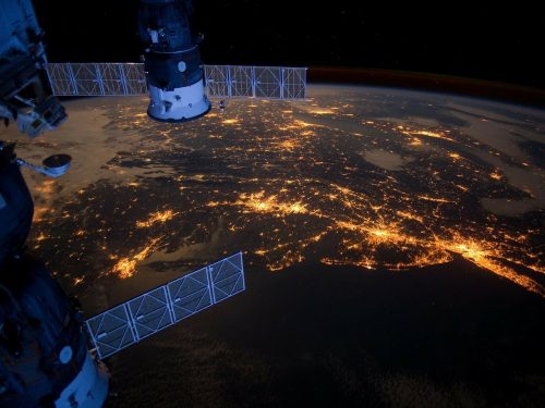
Today, we are immersed in the world of satellite-driven navigation systems and communication networks, our life seems impossible without. But satellite technology has already been playing a far bigger dramatic role in many other areas for a long time.
In this article, we are going to review how various implementations of satellite data, like EOS, are disrupting the traditional agritech sector while creating enormous opportunities for farmers, agronomists, and food manufacturers to address global climate change and agriculture.
Intro: What is Earth Observation
Earth Observation (EO) is both an initiative of world organizations and a general term denoting a stack of remote-sensing technologies designed for gathering global physical, chemical, and biological data with the aid of satellites.
Underpinned by other emerging technologies like Big Data, Artificial Intelligence, Machine Learning, the Internet of Things, and Cloud Computing, EO provides critical environmental information for sustainable development in many fields, where agriculture, land, and water management take a prominent place.
The fast development of satellite technology makes space data delivery affordable for organizations of any size including SMBs, insurance companies, family farmers, and individuals.
Benefits of employing satellite technology in farming
Satellite data help farmers prepare much better for even the subtlest changes in environmental conditions. The EO technology goes far beyond the real-time monitoring of current conditions. It bridges satellite data with AI- and ML-driven analytics to provide accurate future predictions.
Satellite technology enables farmers to:
- know exactly what to grow and when
- control and optimize crop yields
- reduce waste
- monitor soil condition with regard to moisture and fertilization
- provide machine to machine communication
- maximize the overall efficiency and reduce risks
Finally, satellite technology is put into the heart of precision agriculture. Based upon the data-driven satellite technologies, this approach means more accurate planning, more reliable decision-making, and safer investment.
Satellite data and imagery usage
United in clusters, satellites such as the spot 6 satellite, provide rich-data snapshots of the planet’s surface. Transformed into high-resolution imagery, this data allows visualizing changes of agricultural indicators, from soil condition and crop health to efficiency of pests and fertilizers on specific farmland.
Crop health monitoring
Powered by smart differentiation algorithms, satellite vision systems extended into infra-red and ultra-violet spectrum provide accurate green vegetation mapping. This basic data is collected in the form of the Normalized Difference Vegetation Index (NDVI), variations of which are further interpreted and mapped as crop coverage and its health condition (e.g. normal, dehydrated, overhydrated, or sick).
Soil Condition Monitoring
Soil condition monitoring is very much like crop health monitoring. Same way as vegetation, soil can reveal a variety of states in the form of normal, dehydrated, or overhydrated plots unevenly distributed over the farmland due to surface topography. The accurate and well-visualized data of moisture distribution over the farmland means a lot for a farmer.
Resource optimization
One of the most acute issues of contemporary farmers is the optimization of water, fertilizers, and machinery use. The satellite data provide a framework for building a real-time resource management system increasing overall efficiency and reducing waste.
Water management
Data from satellite vision systems provide farmers with insights on where and how much the farmland needs water, preventing under- or over-watering of soil. Blind use of water resources means more than extra cost for a farmer, but it can also negatively impact the environment and wider community.
Soil fertilization
Different crops and land plots require different amounts of fertilizers. Besides, not all crops across the field are in the same condition. The usual practice of blanket fertilizing is often harmful for the future yield, as well as for the local environment.
Satellite soil monitoring programs help farmers introduce the right amounts of fertilizer and figure out the areas on the field which require lower or higher levels of fertilization.
Machine management
Imagine agricultural machinery equipped with sensors and tracking devices driven by satellite data to move without drivers on optimal routes. No extra effort, less fuel, less waste, minimum time. Farmers can focus on other needs.
The road to sustainable agriculture
Globally, agriculture is not just a science integrated into big business. It is much more than an economical issue. The critical growth of population against the background of widely-spread poverty, hunger, and ecological problems elevates the role of agriculture to the highest level.
Satellite technology along with Earth Observation imagery are powerful tools for all agribusinesses today, whether big or small. They will especially come in handy for farmers in developing countries. The emerging technologies, and precision agriculture, in particular, are revolutionizing food production and supply chain without compromising environmental security.
Guided by rich and accurate geospatial data, precision agriculture businesses can optimize management, reduce cost, and potentially double the yields. The use of satellite technology is extending further to more regions on the planet, being applied to an increasing number of crops.
We expect that the so-called ‘sustainable intensification’ process in agriculture geared to Earth Observation technology is capable of changing the face of the world in a decade.
Interesting Related Article: “Satellite Internet May Become More Economical and Faster”