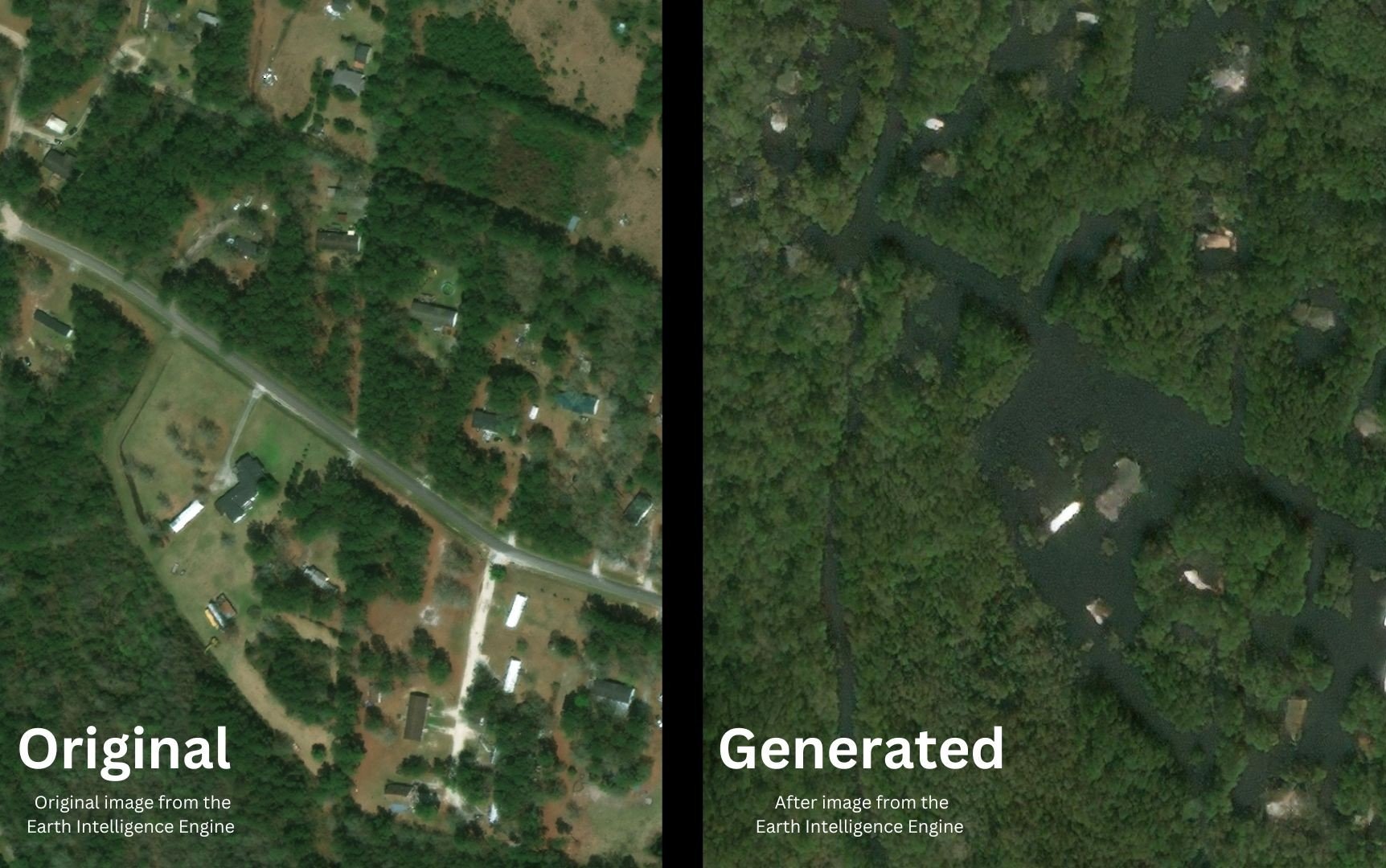
A new tool could completely change how communities prepare and respond to major storms. How? By showing a clear picture of the potential damage before it happens.
MIT researchers have devised a way to create satellite images that show how flooding could look after a big storm. They call it the Earth Intelligence Engine and it combines AI with real-world flood data to make the visuals.
The team tested their approach on Houston. They created a scenario similar to Hurricane Harvey, which devastated the area in 2017. By combining AI with physical flood models, they created satellite images showing specific neighborhoods under water. The results were very close to what actually happened during Harvey, adding credibility to the tool’s accuracy. And when they compared their novel method to traditional AI-generated imagery, the difference was clear. The older AI tools painted floods in places where water couldn’t possibly reach—like on higher ground. The new system did not make those mistakes.
The Earth Intelligence Engine could make a difference in how communities prepare for storms. Color-coded flood maps only go so far in connecting with people. They’re technical, abstract, and for many people? Easy to brush off. But showing people what their homes might actually look like after a flood? That’s personal. It’s emotional. It sticks.

“We show a tangible way to combine machine learning with physics for a use case that’s risk-sensitive, which requires us to analyze the complexity of Earth’s systems and project future actions and possible scenarios to keep people out of harm’s way,” said Dava Newman, the study’s senior author. “We can’t wait to get our generative AI tools into the hands of decision-makers at the local community level, which could make a significant difference and perhaps save lives.”
Björn Lütjens, another one of the researchers, pointed out a huge challenge: convincing people to evacuate when their lives are in danger. Often, people don’t move until it’s too late. Perhaps seeing their home surrounded by water in a realistic image could change that.
“The idea is: One day, we could use this before a hurricane, where it provides an additional visualization layer for the public,” said Lütjens, a postdoc in MIT’s Department of Earth, Atmospheric and Planetary Sciences. “One of the biggest challenges is encouraging people to evacuate when they are at risk. Maybe this could be another visualization to help increase that readiness.”
The potential goes beyond flooding. The system could also tackle other environmental challenges, like showing the effects of deforestation or the shrinking of Arctic ice.
The team released the Earth Intelligence Engine online for others to try.
Citation:
B. Lütjens et al., “Generating Physically-Consistent Satellite Imagery for Climate Visualizations,” in IEEE Transactions on Geoscience and Remote Sensing, doi: 10.1109/TGRS.2024.3493763.
