Nearly 12% of the Greenland ice sheet had more than 1mm of melt by 11th April this year, one month earlier than the previous record of 10% by 5th May in 2010, say Danish scientists, who expressed alarm at such an early thaw.
These figures are according to an observation-initialized weather model carried out by the Danish Meteorological Institute (DMI), which makes weather forecasts and observations for Denmark, Greenland, and the Faroe Islands.
Weather specialists were so shocked by the Greenland ice sheet melt figures that they checked and double-checked that their models had been working properly.
 Maps showing areas where melting has occurred within the last two days. (Image: polarportal.dk)
Peter Langen, a climate scientist at DMI, said:
“We had to check that our models were still working properly. Fortunately we could see from the PROMICE.dk stations on the ice sheet that it had been well above melting, even above 10 °C. This helped to explain the results.”
The previous three records for a melt area greater than 10% occurred on:
– 5th May 2010,
– 8th May 1990,
– 8th May 1990.
An almost 12% melt by 11th April is considerably earlier than any climate expert could have imagined.
 The percentage of the total area of the ice where the melting took place from January 1st until 11th April (blue). The dark grey graph represents the 1990-2013 average. The grey shaded area represents the year-to-year variation for each day. (Image: polarportal.dk)
Warmer temperatures at high altitudes too
Robert Fausto, a scientist at GEUS (Geological Survey of Denmark and Greenland – De Nationale Geologiske Undersøgelser For Danmark Og Grønland) who maintains PROMICE.dk melt data, said:
“Even weather stations quite high up on the ice sheet observed very high temperatures on Monday. At KAN_U for example, a site at 1840 m above sea level, we observed a maximum temperature of 3.1°C.”
“This would be a warm day in July, never mind April.”
In other parts of Greenland where PROMICE stations are located at lower levels, daily average temperatures were between 5°C and 10°C.
Likewise, around Greenland’s coast, where DMI has been registering climate records since 1873, a high-temperature record was nearly set for the whole of Greenland in April this year.
Kangerlussuaq, a settlement in western Greenland, registered a daily maximum of 17.8°C, while the DMI observation station at the Summit of Greenland, located 3,216 metres (10,551 ft) above sea level, set a new ‘warm’ April record of -6.6°C.
Nuuk residents commenting on abnormal April
Residents at Nuuk, the capital and largest city in Greenland, with a population of 16,583, have been commenting on the abnormal April weather. “Everything is melting,” said Aqqaluk Petersen, who lives in Nuuk.
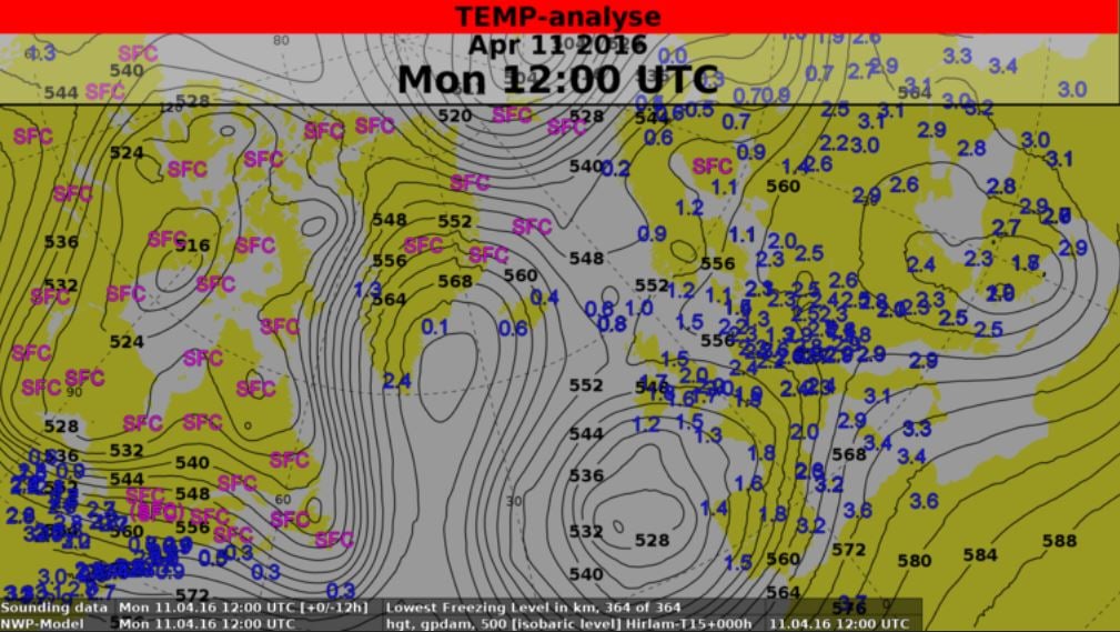
 This map shows the abnormal flow pattern over Greenland on Monday, 11 April 2016, 18 UTC. Lines (isohypses) connect points of equal height of the 500 hPa pressure level, a measure of the average temperature between surface and 5-6 km height. The coloured numbers show us the freezing level (i.e. below which the temperature is above zero degrees; SFC means that this level is at the surface) in kilometers. (Image: polarportal.dk)
The ice melt was driven by warm air advected from the south west, which brought rain along the coast, similar to a 2012 extreme melt when ninety-five percent of the surface of the ice sheet had melt, a situation that has been reported in detail by DMI and GEUS scientists (Fausto et al., 2016).
Regarding the current situation so early in the year, DMI climate scientist Martin Stendel said:
“It is a very unusual situation, especially so early in the year, with very cold air and deep low pressures system to the west and east of Greenland and very warm air forming a “cap” over the island. This helped to force a frontal system with very warm air up the west coast bringing rain over the ice sheet.”
“A freezing level of 2.4 km over Narsarsuaq is highly unusual (compare to Portugal), as is a 500 hPa height of almost 5760 m, a value typically observed in the subtropics – in summer. The very cold weather by contrast in north eastern Greenland is exactly what we would expect with this pattern.”
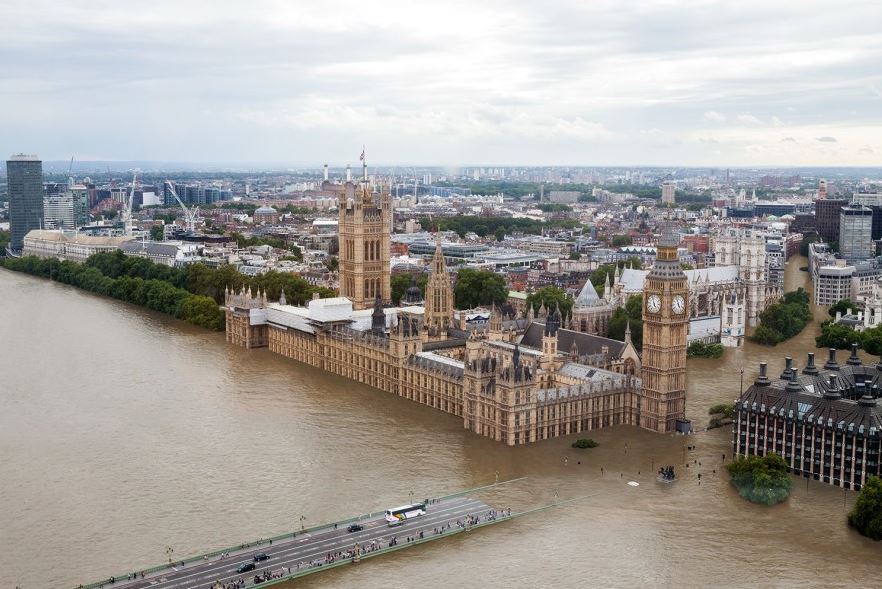
 This is what London would look like if all the Greenland ice sheet melted and sea levels rose by 20 feet. (Image: asset.inhabitat.com)
Temperatures should fall this week
Jesper Eriksen and Marie Rasmussen, two DMI weather forecasters, say they expect temperatures across Greenland to gradually drop over the coming week, though a new frontal system from Thursday might again cause extensive melt, especially in the south.
Most of the meltwater on the ice sheet and rainfall at this time of year runs into the snow and freezes up again.
Professor Jason Box, who works at GEUS and together with Fausto and DMI & DTU colleagues, leads a Danish Research Council project, said:
“Meltwater refreezing releases heat into the snow at depth, reducing the amount of heating needed for melt to start and forming ice layers that can help melt water run off the ice sheet earlier with climate warming.”
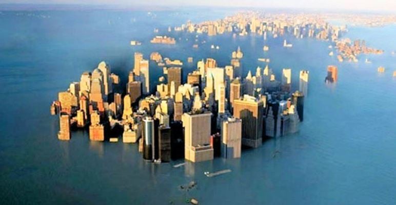
 If all the Greenland ice sheet melted, much of New York City would become inhabitable. (Image: citizenactionmonitor.files)
Why does Greenland ice sheet matter?
The Greenland ice sheet extends about 656,000 square miles (1.7 sq km), covering most of Greenland – about three times the size of Texas.
If all the Greenland ice sheet melted, the National Snow and Ice Data Center estimates that the global sea level would rise by about 20 feet (6 metres).
Such a rise in the sea level would make several cities across the world uninhabitable, including many in Florida, several parts of the United Kingdom (including most of London), most of the Netherlands, Bangladesh, and many other parts of the world. Put simply – it could be a catastrophe for us.
Video – Greenland’s Ice Sheet Melting Faster Than Ever
