
Ordnance Survey has produced a digital map of a part of Mars to determine whether it has potential for future missions to the Red Planet. The UK’s national mapping agency, a government-owned company, one of the largest producers of maps in the world, says it was the first time its world-leading cartography technology was used to map another world.
The map was created for a British scientist who is planning the landing of the European ExoMars rover in 2019.
David Henderson, Ordnance Survey Director of Products, said regarding the map of Mars:
“The private sector and space agencies are currently in competition to land the first person on Mars. Becoming more familiar with space is something that interests us all and the opportunity to apply our innovative cartography and mapping tradecraft to a different planet was something we couldn’t resist.”
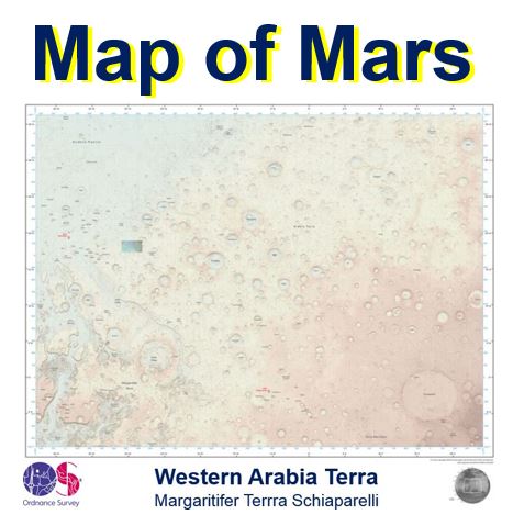
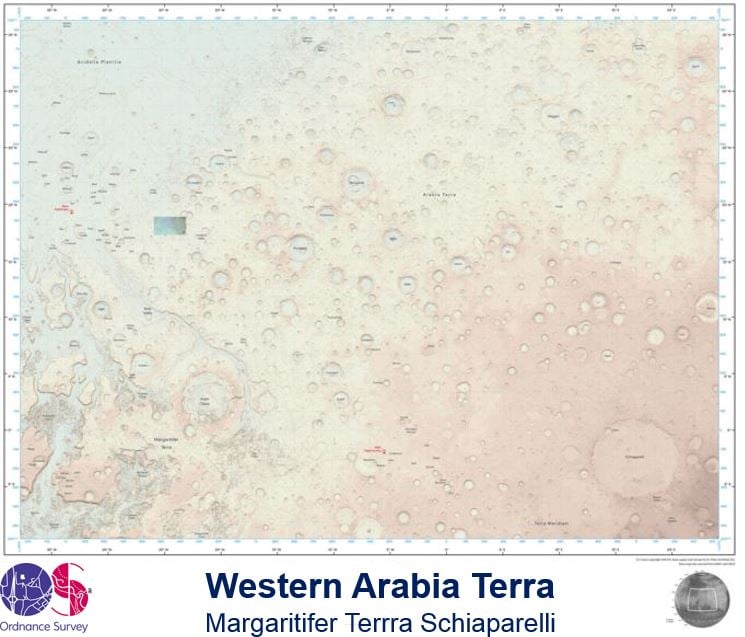 The partial map of Mars, which was created from NASA elevation data, covers an area roughly equivalent to the size of the US or forty times the size of the UK – equal to 7% of the Red Planet’s surface. (Image: .flickr.com/photos)
Ordnance Survey maps easy to understand
The Southampton-based company was asked to Map an area of the Red Planet because it was told its maps are easy to understand and present a compelling visulation “and because of this we can envisage their usefulness in planning missions and for presenting information about missions to the public,” Mr. Henderson added.
The new map, which has been produced to a scale of 1 to 4,000,000, covers a 3,672 by 2,721 km extent of the surface of Mars.
Ordnance Survey Cartographic Design Consultant, Chris Wesson, who designed the map, said he and his team set out right from the start to treat the Mars data the same as they would treat UK map information or any other Earth-based geography.
Regarding the design and aesthetics of a Mars map, Mr. Wesson said:
“Even though the principles are the same, the design and the aesthetics of an Earth map differ considerably. The cartographic style is something that is very different to your typical planetary map and is identifiable as an OS (Ordnance Survey) map.”
“The key ingredients to this style are the soft colour palette of the base combined with the traditional map features such as contours and grid lines, and the map sheet layout complete with legend.”
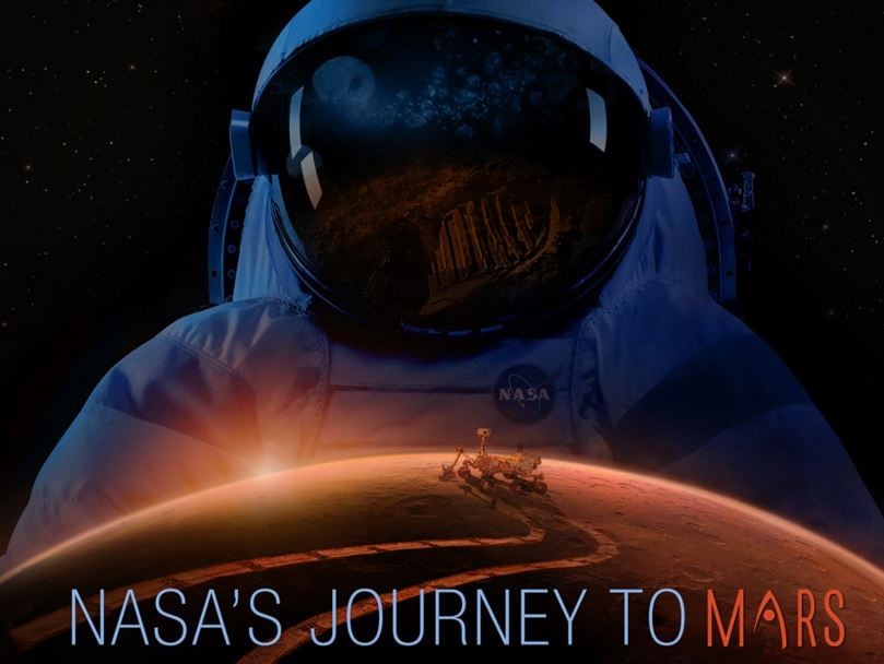 In future missions to Mars, either by humans or rovers, an easy-to-use map of the planet is important. (Image: NASA)
Ordnance Survey said there is no equal or equivalent anywhere in the world to the depth and breadth of data it produces and manages.
It is used by individuals, businesses and governments in keeping the country, economy and infrastructure moving.
The data is so massive, while at the same time so granular and precise, that the location of every single fixed physical object in the United Kingdom, from the ground upwards, is registered.
Its enormous database is kept up-to-date by a team of 270 surveyors and airplanes that produce over 10,000 updates to the system every single day.
Ordnance Survey born 225 years ago
This year, Ordnance Survey is 225 years old. It says that producing the Mars map has been a major milestone for the organization. The last time it created a map outside of the British Isles was in the mid-1990s.
The idea for the Ordnance Survey map of the Red Planet came from Dr. Peter Grindrod, a Lecturer in Planetary Science at the Department of Earth and Planetary Sciences, Birkbeck, University of London, said Mr. Wesson.
Dr. Grindrod was working of whether he could take a typical map of Mars and make it look like the kind of map OS is famous for (easy to read).
“We were talking it through,” Mr. Wesson explained “and we decided it might be a good idea to have a more recognised style of map to be use as a base for mapping the future Mars missions.”
Video – We are Ordnance Survey