Just as everybody was wondering whether they had seen the last remnants of winter, the UK’s Environment Agency warned of super tides, floods, gale force winds, snow and storms this weekend, probably continuing on Monday.
The super tides are caused by the Moon and Sun moving into a rare alignment, thus increasing their gravitational pull on our seas. Weather experts say strong winds in several parts of the country, especially along coastal areas, will exceed 50 mph.
The gravitational pull of the Sun and the Moon combined occurs more frequently in the Spring. At the moment, however, their combined pull is at an 18-year high, meaning tides will be slightly larger in 2015.

According to weather forecasters, the UK will get a strong reminder this weekend that winter is not over.
To cap it all, a fierce storm is coming our way from the Atlantic.
Several parts of the South East of England woke up to a powdering of snow this morning, while forecasters warn of blizzard conditions in northern areas.
The Environment Agency issued six “immediate action required” alerts for the southwest, mainly for the Somerset coast, and five for the northwest.
The Wye Estuary in the Midlands received two weather alerts. Lower-level amber flood alerts were issued across the country. An amber alert means there is a serious risk of flooding.
Sky News quoted Jonathan Day of the Environment Agency, who said:
“It’s possible we could see some large waves and spray and urge people to take care near coastal paths and promenades and not to drive through flood water.”
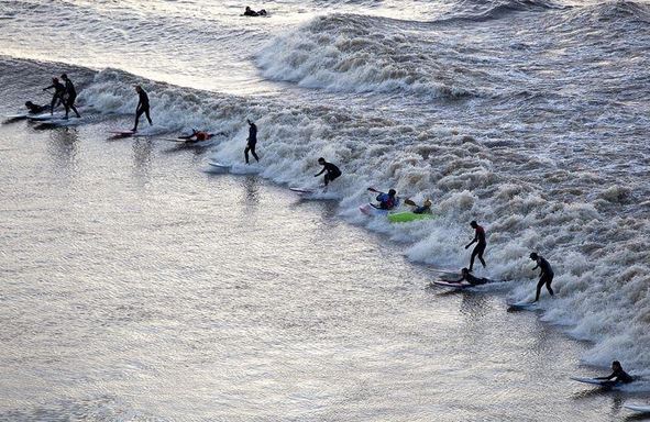
Spectacular Severn Estuary tidal bore

Surfers at the Severn Estuary enjoying the tidal bore. In a tidal bore, the leading edge of the incoming tide forms a wave (or waves) of water that travels up the estuary against the direction of its current.
On Saturday morning, surfing enthusiasts gathered to make the best of the super wave (bore wave) on the River Severn. Crowds of spectators stood on the banks to watch the waves which can reach a height of up to three metres (9ft 10ins) and speeds in excess of 13 mph.
The North of England, the Pennine areas and the Highlands are forecast to have blizzard conditions this weekend.
Devon authorities have issued several high tide alerts, adding that unsettled weather could bring localized flooding to coastal towns and villages.
The Environment Agency warned that the towns of Clevedon, Chepstow and Sheeway are directly in the firing line of the storm that is sweeping in from the Atlantic.
Hundreds of sandbag alerts have been issued in coastal areas.

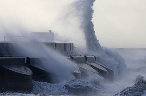
Powerful waves will hit coastal towns, which are already suffering from serious erosion.
Several southeastern counties, including Kent, Surrey and East Sussex saw sizeable amounts of snow this morning.
With temperatures forecast to plunge below zero on Saturday night, more wintry showers are expected to sweep across the nation on Sunday morning.
Met Office forecaster Simon Partridge said:
“The whole of the country will experience strong winds and severe gales over the course of tomorrow, meaning it will be a wet and windy day for many – and a snowy and windy day for northern parts. Winter is not over just yet.”
The Environment Agency, in an alert for the River Thames riverside from Putney Bridge to Teddington Weir, wrote “The river flow at Teddington Weir is normal for this time of year at 115 cubic metres per second and is rising, likely to peak around 155 cubic metres per second.”
In an interview with This is The West Country quoted Jonathan Day, flood risk manager at the Environment Agency, said:
“We are monitoring the situation closely with the Met Office and will issue flood alerts and warnings as required. It’s possible we could see some large waves and spray and urge people to take care near coastal paths and promenades and not to drive through flood water.”
“People should also check their flood risk and keep up to date with the latest situation on the GOV.UK website or follow @EnvAgency and #floodaware on Twitter for the latest flood updates.”
Wales Online says the country could be in for a year of “supertides” and potential flooding along much of its coastline.
